Time Travel Through Our Photo Gallery
Independence Square, Independence, MO - Santa Fe, Oregon, & California Trails
Independence MO was one of the earliest sites associated first with the Santa Fe and later with the Oregon-California bound travelers. It is also associated with the Mormons. Independence Square marks the center of the town. Wagons still provide rides for the tourist traveler.
Independence MO was one of the earliest sites associated first with the Santa Fe and later with the Oregon-California bound travelers. It is also associated with the Mormons. Independence Square marks the center of the town. Wagons still provide rides for the tourist traveler.
Hollenberg/Cottonwood Ranch Station, Hanover, KS – Oregon, California, & Pony Express trails
Hollenberg Ranch was constructed in 1857 in three stages. It became a Pony Express station in 1860. It is the only station still on its original site and the only ranch structure still standing. Its huge barn stood in front across the road in what is now a field.
Hollenberg Ranch was constructed in 1857 in three stages. It became a Pony Express station in 1860. It is the only station still on its original site and the only ranch structure still standing. Its huge barn stood in front across the road in what is now a field.
Wagon Ruins in Giant Swale at Rock Creek Station, NE
The remnants of an old wagon along side the deep swales of the Oregon-California-Pony Express trails at Rock Creek Station, NE. The reconstruction of the buildings at this historic site depicts the site in 1859.
Trail swale & cut at California Hill, Brule, NE – Oregon & California Trails
A closeup of the trail with a person in frame gives you a visual perspective of the depth of the cuts in the trail.
A closeup of the trail with a person in frame gives you a visual perspective of the depth of the cuts in the trail.
Trail swale & cut at California Hill, Brule, NE – Oregon & California Trails
West of Brule, NE, the emigrants forded the South Platte River and commenced a long climb up the hill to a plateau and headed for the North Platte. Near the top the trail cut deep into the ground. The trail then headed northwest to cross the dry plateau where it dropped into the valley of the North Platte River at Ash Hollow. Today the site is called California Hill
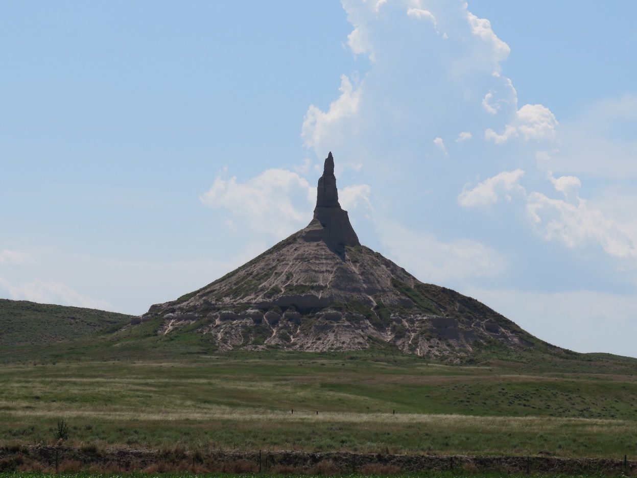
Chimney Rock, Bayard, NE – Oregon, California, Pony Express, & Mormon Trails
Chimney Rock was the most recorded and sketched landmark on the trails. It was one of the first unique formations on the Platte River along the stretch of the trail west to Scott’s Bluff. Many an emigrant walked away from the trail to see it close-up. Today it is much shorter, and all the emigrant names have washed away. There is a fine visitor center and a walking path for those who want to get an even closer view today. It could be seen by travelers on the trails on both sides of the Platte River for two days before and two days after passing it.
Chimney Rock was the most recorded and sketched landmark on the trails. It was one of the first unique formations on the Platte River along the stretch of the trail west to Scott’s Bluff. Many an emigrant walked away from the trail to see it close-up. Today it is much shorter, and all the emigrant names have washed away. There is a fine visitor center and a walking path for those who want to get an even closer view today. It could be seen by travelers on the trails on both sides of the Platte River for two days before and two days after passing it.
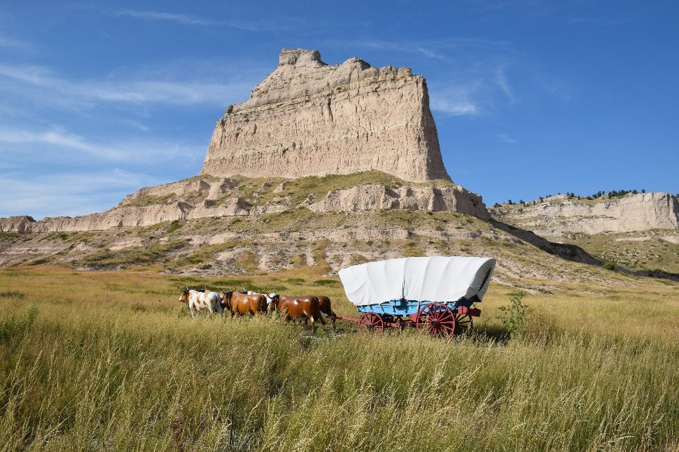
Wagon Display - entering Mitchell Pass at Eagle Rock, Scott’s Bluff, NE
In 1851 the emigrants began using the pass in the Scotts Bluffs. Today, it is known as Mitchell Pass. This shows part of the wagon display with the large formation of Eagle Rock in the background.
In 1851 the emigrants began using the pass in the Scotts Bluffs. Today, it is known as Mitchell Pass. This shows part of the wagon display with the large formation of Eagle Rock in the background.
Wagon display in Mitchell Pass at Scotts Bluff, Gering NEMost emigrants did not use the large Conestoga Wagon but a smaller farm wagon.
Looking back at Mitchell Pass, Scotts Bluff
Tourists can walk on the path along the route of the trail through the pass.
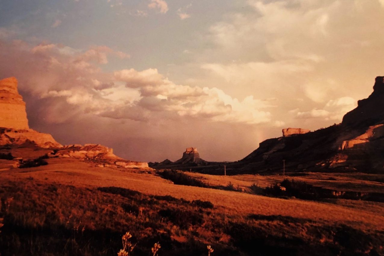
Sunset and Rainbow from Mitchell Pass
A beautiful sunset and rainbow at Mitchell Pass with Dome Rock in the background.
A beautiful sunset and rainbow at Mitchell Pass with Dome Rock in the background.
Ft. Laramie, WY - Old Bedlam, - Oregon, California, Mormon, & Pony Express Trails
Fort Laramie was established in 1834 as a wooden stockade fort. It was named Fort William In 1841 it was replaced with an adobe structure known as Fort John. In 1849 it was sold to the US Army and rapidly expanded. Old Bedlam served as the Officers’ Quarters. For the emigrants it marked the end of plain and 1/3 of their journey. Today the site is considered a crown jewel of the National Park Services Historic Sites.
Fort Laramie was established in 1834 as a wooden stockade fort. It was named Fort William In 1841 it was replaced with an adobe structure known as Fort John. In 1849 it was sold to the US Army and rapidly expanded. Old Bedlam served as the Officers’ Quarters. For the emigrants it marked the end of plain and 1/3 of their journey. Today the site is considered a crown jewel of the National Park Services Historic Sites.
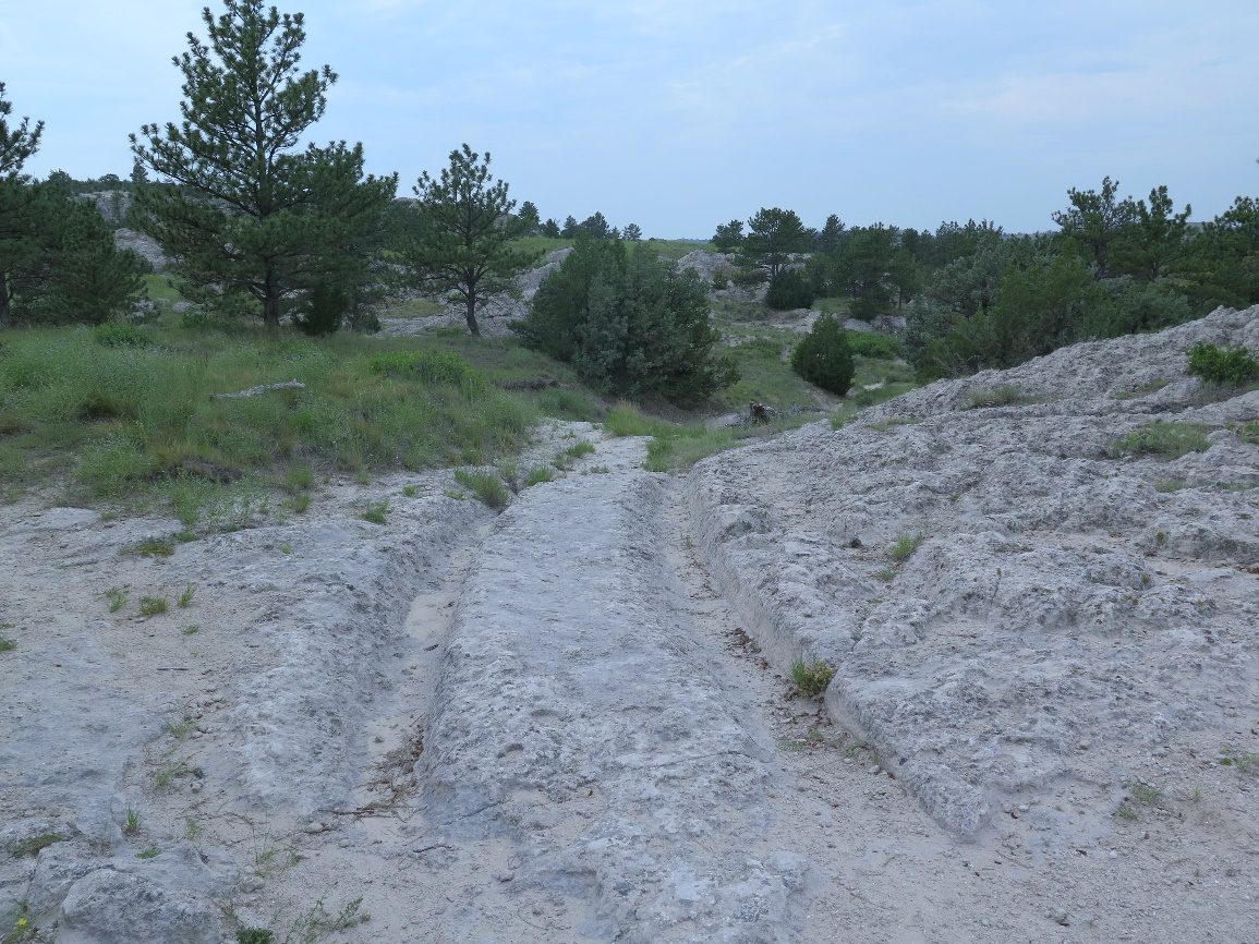
Trail ruts cut into the limestone, Guernsey, WY - Oregon, California, Mormon, & Pony Express Trails
This is part of Guernsey’s Trail Ruts State Park. The North Platte River cut close to the rocky hills and the trail was forced to climb up them resulting in the woven web of ruts and swales found today. In some parts the trail is cut three feet into them while, in others such as here, the 9” wheel ruts are clearly evident.
This is part of Guernsey’s Trail Ruts State Park. The North Platte River cut close to the rocky hills and the trail was forced to climb up them resulting in the woven web of ruts and swales found today. In some parts the trail is cut three feet into them while, in others such as here, the 9” wheel ruts are clearly evident.
Rainbow and bridge over the trail, Independence Rock, WY - Oregon, California, Mormon, & Pony Express Trails
The Oregon, California, Mormon and Pony Express trails all passed Independence Rock. The trail, worn into the ground here by thousands of wagons and people is clearly visible. Today, visitors using the bridge walk over it.
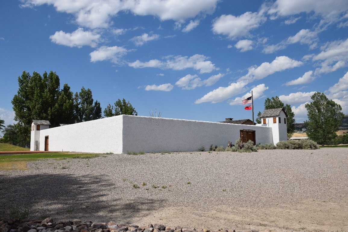
Fort Hall Replica, Pocatello, ID - Oregon & California Trails
Fort Hall was established in 1834 on the Snake River by Nathaniel Wyeth during the fur trade era. During the westward migration of the 1840s & 50s it served as the last major resupply post on the Oregon & California Trails for those emigrants who did not take one of the earlier cutoffs that developed before reaching Fort Hall. The trading fort was abandoned in 1856.
Fort Hall was established in 1834 on the Snake River by Nathaniel Wyeth during the fur trade era. During the westward migration of the 1840s & 50s it served as the last major resupply post on the Oregon & California Trails for those emigrants who did not take one of the earlier cutoffs that developed before reaching Fort Hall. The trading fort was abandoned in 1856.
Sunset at Three Buttes near Fort Hall, ID on the Oregon - California Trail.The large butte silhouetted on horizon is one of Three Buttes, landmarks that were visible to the trappers and emigrants as they entered the Snake River valley and approached the fort, and after they left it following the river west. The view is from another landmark, American Falls, on the Snake River about 22 miles west of the fort’s site.
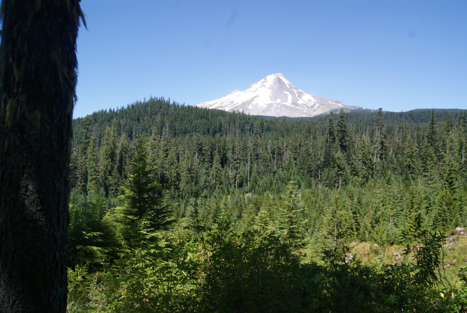
Mount Hood, OR - Oregon Trail
This view of Mt. Hood is from off the Barlow Road at summit meadows. This landmark was a clear indicator that the end of the trail was getting close. Mount Hood was first seen in the west when the emigrants started their descent from the Blue Mountains. At The Dalles on the Columbia the emigrants had two choices, raft down the dangerous Columbia or climb around the rugged Mount Hood on the Barlow Road to the Willamette Valley.
This view of Mt. Hood is from off the Barlow Road at summit meadows. This landmark was a clear indicator that the end of the trail was getting close. Mount Hood was first seen in the west when the emigrants started their descent from the Blue Mountains. At The Dalles on the Columbia the emigrants had two choices, raft down the dangerous Columbia or climb around the rugged Mount Hood on the Barlow Road to the Willamette Valley.
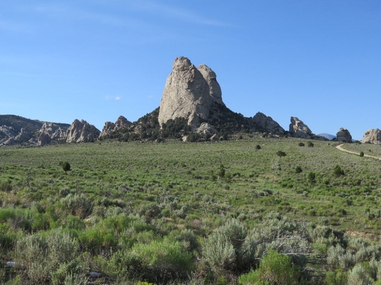
Looking north at the Twin Sisters (Steeple Rocks), California Trail- ID
This formation was a landmark on the California Trail after it cut-off from the Oregon Trail west of Fort Hall. It is located at the south end of City of Rocks, near Almo, ID. It also marked the junction with the Salt Lake Cut-off coming up on the east side of the Great Salt Lake and Salt Lake City.
This formation was a landmark on the California Trail after it cut-off from the Oregon Trail west of Fort Hall. It is located at the south end of City of Rocks, near Almo, ID. It also marked the junction with the Salt Lake Cut-off coming up on the east side of the Great Salt Lake and Salt Lake City.
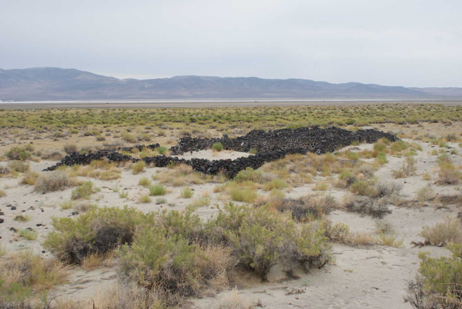
Sand Springs Pony Express Station ruins, NV - the Central Route of the California & Pony Express Trails
The ruins at Sand Springs clearly indicate the corral, stable area, and living quarters. It served as both an Overland Stage and a Pony Express station. The trail aimed for the low rise at the ridge edge of the photo. After climbing the rise the trail dropped down to Carson Lake.
The ruins at Sand Springs clearly indicate the corral, stable area, and living quarters. It served as both an Overland Stage and a Pony Express station. The trail aimed for the low rise at the ridge edge of the photo. After climbing the rise the trail dropped down to Carson Lake.
Sunset at Fort Churchill, NV – California, Carson Route, & Pony Express Trails
Fort Churchill was built on the California-Pony Express trails during the Paiute War. It replaced the Buckland Ranch station for the Pony Express. Today the ruins of the fort have been stabilized. The site is located near the Big Bend of the Carson River south of Silver Springs,NV.
Fort Churchill was built on the California-Pony Express trails during the Paiute War. It replaced the Buckland Ranch station for the Pony Express. Today the ruins of the fort have been stabilized. The site is located near the Big Bend of the Carson River south of Silver Springs,NV.
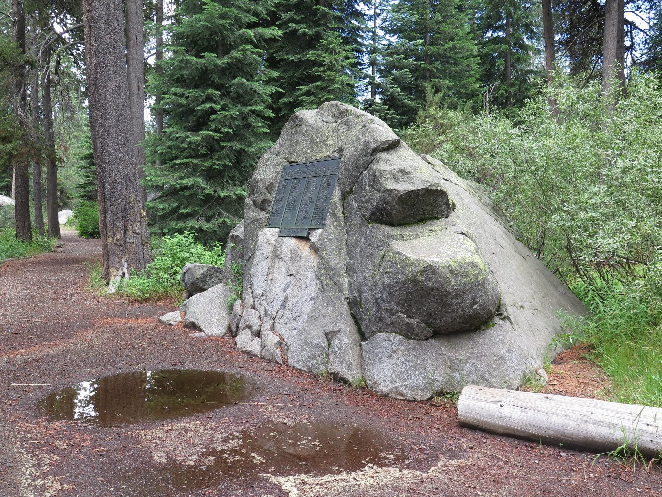
Cabin Rock, Donner State Park, CA - California Trail, Truckee route
This large rock served as one of the walls of a cabin built by members of the Donner Party when they were they were forced by deep snows to spend the terrible winter of 1846-7 on the eastern side of the Sierras. Today you can visit the site in Donner State Park in Truckee, CA. The plaque on the rock has the names of the Donner Party, both those who died and those who survived and were rescued.
This large rock served as one of the walls of a cabin built by members of the Donner Party when they were they were forced by deep snows to spend the terrible winter of 1846-7 on the eastern side of the Sierras. Today you can visit the site in Donner State Park in Truckee, CA. The plaque on the rock has the names of the Donner Party, both those who died and those who survived and were rescued.
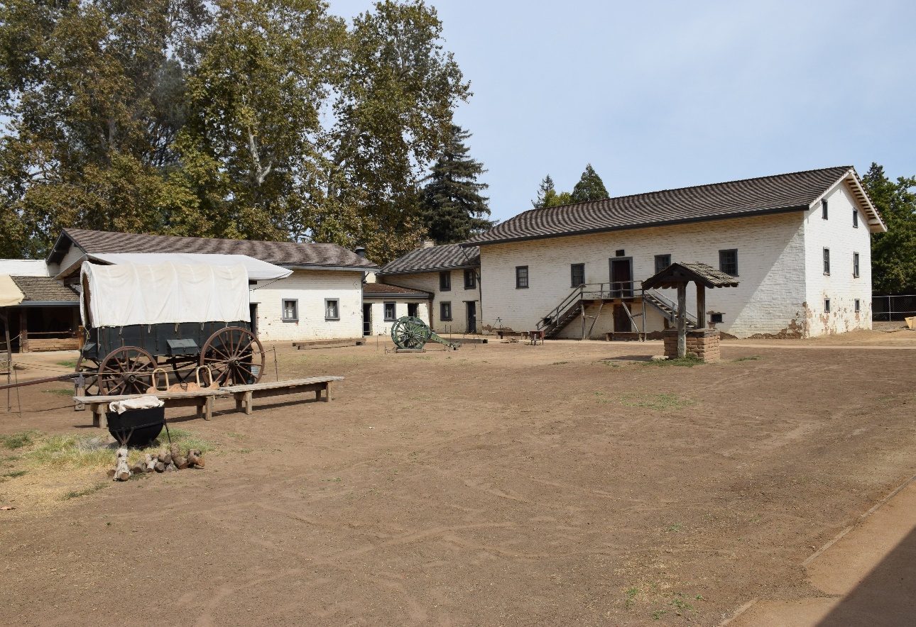
Sutter’s Fort, Sacramento, CA - California Trail
For many an emigrant Sutter’s Fort was the end of their long journey. It was the center of John Sutter’s empire. He helped many of the early emigrants. With the discovery of gold at his sawmill everything soon changed. The large building on the right is original. The rest of the present fort’s structures have been reconstructed.
For many an emigrant Sutter’s Fort was the end of their long journey. It was the center of John Sutter’s empire. He helped many of the early emigrants. With the discovery of gold at his sawmill everything soon changed. The large building on the right is original. The rest of the present fort’s structures have been reconstructed.
Bent’s Old Fort Reproduction, LaJunta, NM
Approaching the the famous trading post which was built in 1833 by William Bent. It was named “Fort William” but was commonly called “Bent’s Fort.”
Approaching the the famous trading post which was built in 1833 by William Bent. It was named “Fort William” but was commonly called “Bent’s Fort.”
Bent’s Old Fort Reproduction, LaJunta, NM
William Bent traded with the Indians in the area, and it became a major stop for trappers, traders and other travelers on the Mountain Branch on their way to Santa Fe and farther south in Mexico. The post was abandoned in 1849.
William Bent traded with the Indians in the area, and it became a major stop for trappers, traders and other travelers on the Mountain Branch on their way to Santa Fe and farther south in Mexico. The post was abandoned in 1849.
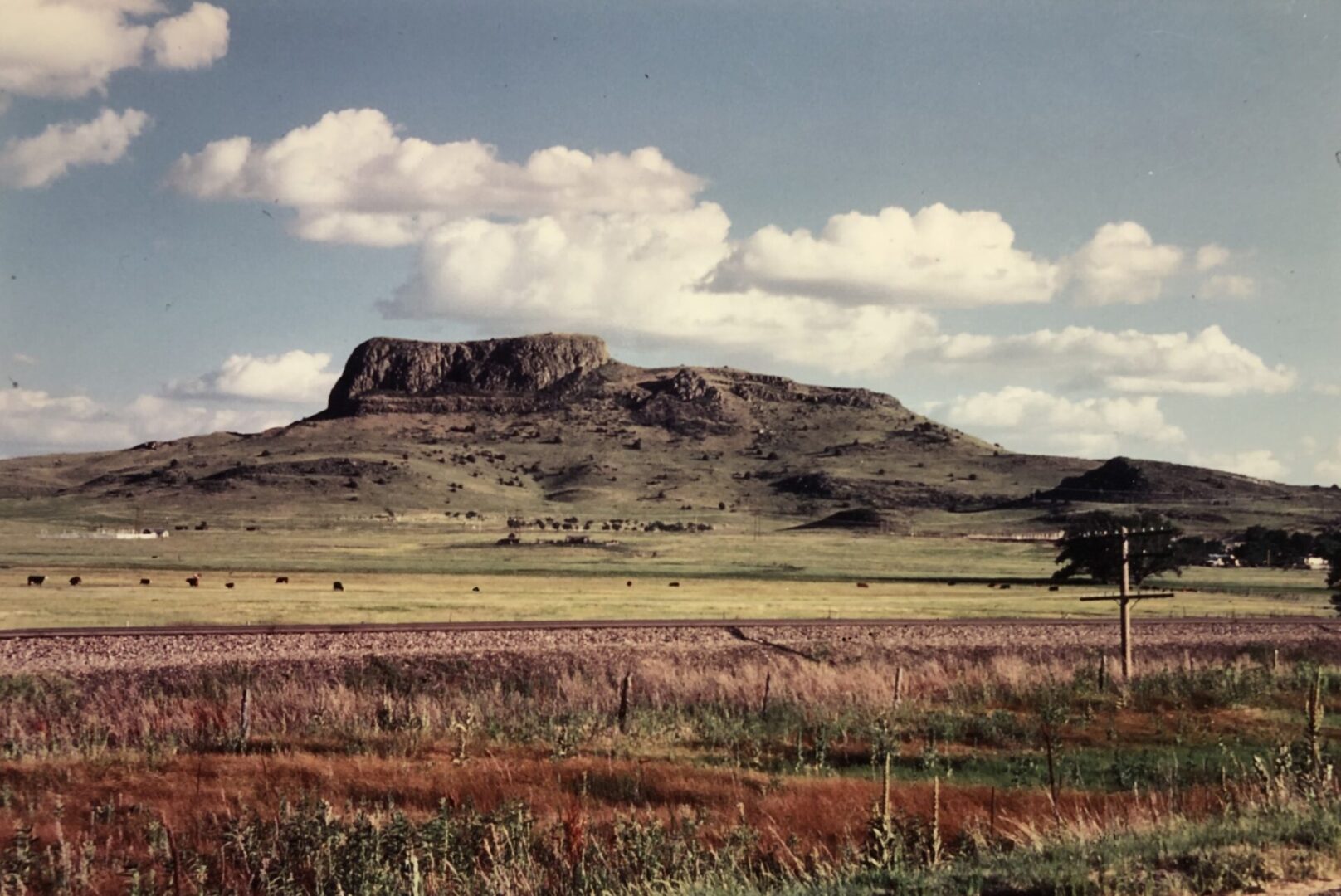
Looking south Wagon Mound, NM – Santa Fe Trail
Looking south at Wagon Mound, NM - The formation was a famous landmark on the Santa Fe Trail. While some early travelers saw the silhouette of a shoe, most saw a wagon and animals heading west. Here the old trail, railroad, and modern interstate are all nearly parallel as they turned west in front of the formation towards Santa Fe.
Looking south at Wagon Mound, NM - The formation was a famous landmark on the Santa Fe Trail. While some early travelers saw the silhouette of a shoe, most saw a wagon and animals heading west. Here the old trail, railroad, and modern interstate are all nearly parallel as they turned west in front of the formation towards Santa Fe.
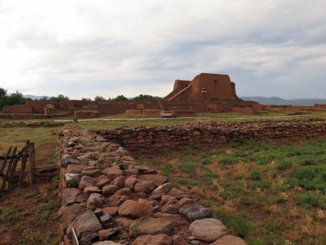
Old Pecos Ruins, NM - Santa Fe Trail
Pecos was an old town that had deteriorated and was in ruins before the 1840s. The old cathedral’s ruins was nearly twice its size then. It was a “tourists’ attraction” for the travelers and traders on the Santa Fe Trail. Today paths take visitors around the ruins, and the site has been stabilized by the National Park Service.
Pecos was an old town that had deteriorated and was in ruins before the 1840s. The old cathedral’s ruins was nearly twice its size then. It was a “tourists’ attraction” for the travelers and traders on the Santa Fe Trail. Today paths take visitors around the ruins, and the site has been stabilized by the National Park Service.
